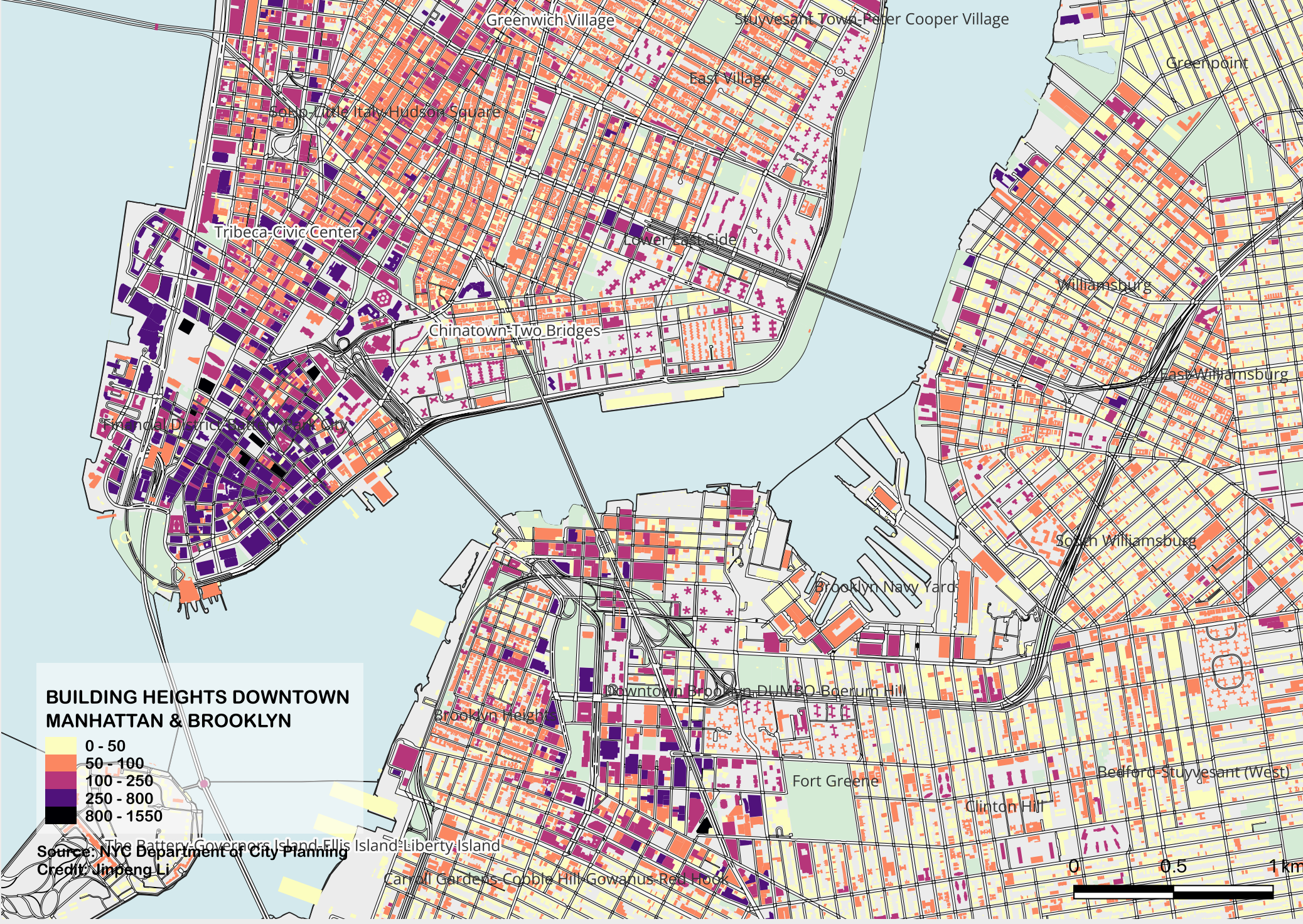
This map show the heights of the buildings in New York:
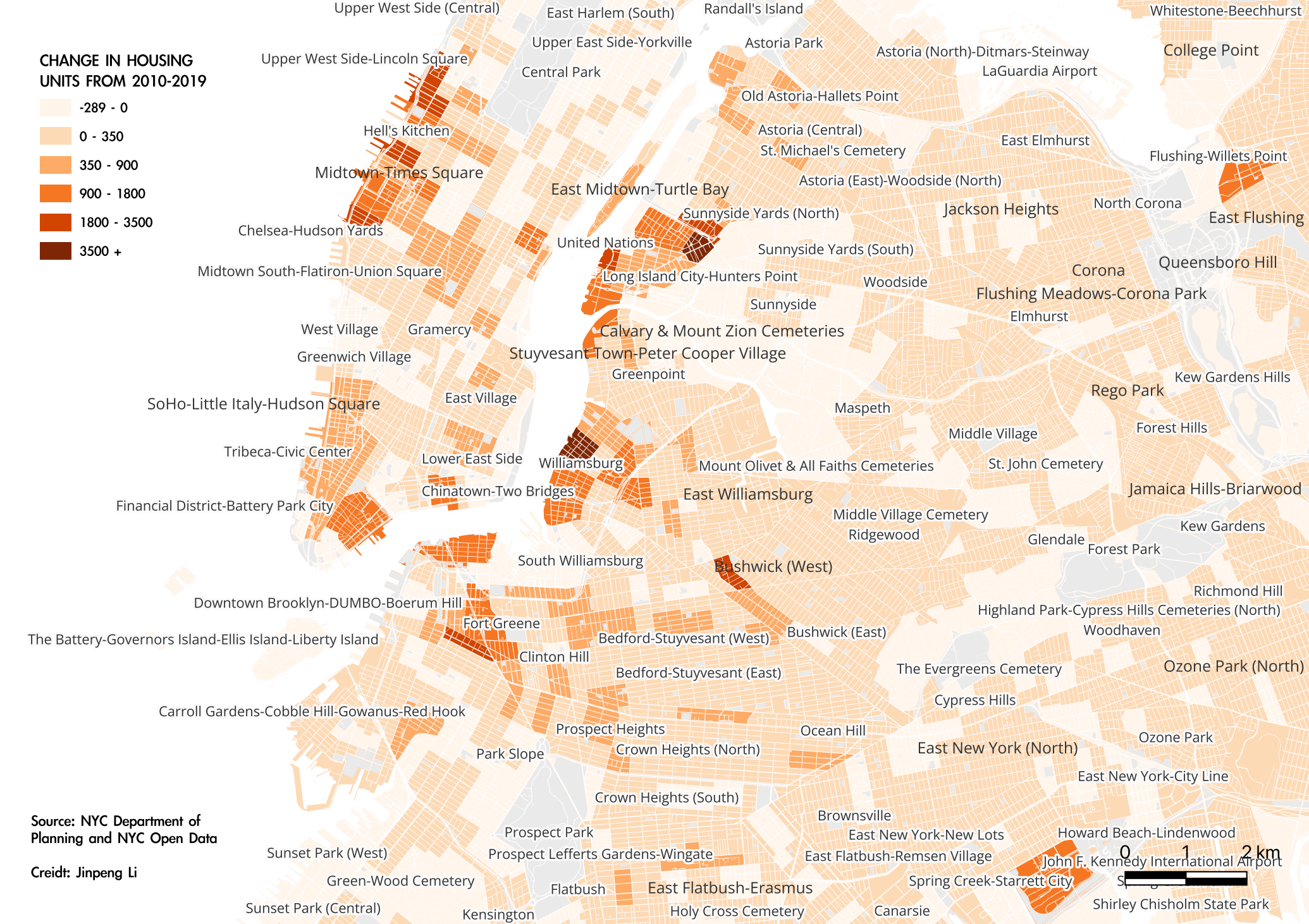
A basic map showing NYC-based housing development from 2010-2019:
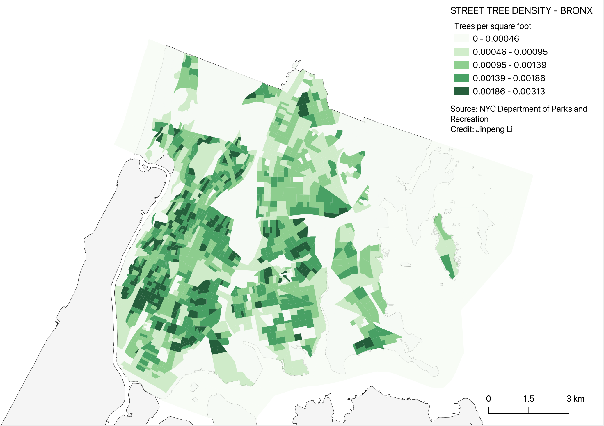
The geographic coordinates of street trees in New York were imported into QGIS from a CSV file in order to analyze the street tree density:
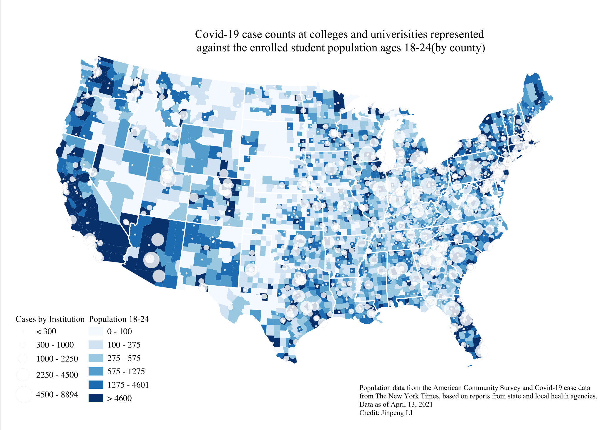
A graduated cylinder maps of Covid rates at Colleges:
These maps were followed tutoria by Columbia University's GIS mapping course.